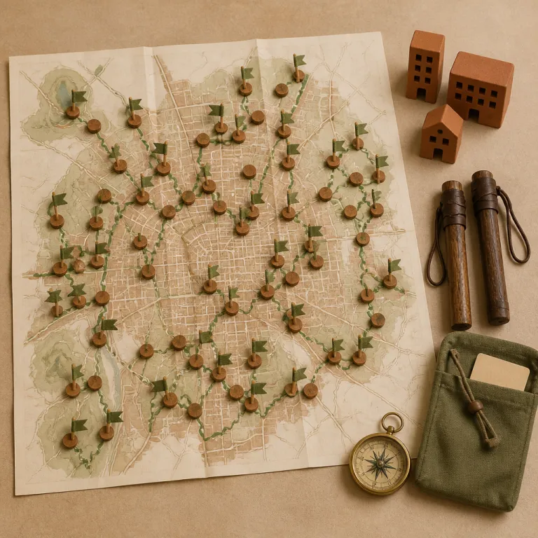
Why Beijing’s new greenway system matters for luxury travelers
Beijing has quietly built a greenway system of more than four thousand kilometers that changes how you move through the city. According to recent figures released by the Beijing Municipal Bureau of Culture and Tourism, the total length of completed corridors now exceeds 4,000 km, linking rivers, parks, and urban neighborhoods into a single network. For couples used to crossing a ring road by car between hotel, restaurant, and gallery, these landscaped corridors turn the capital into a walkable landscape where river, forest, and gardens sit one trail away from your suite. This is the Beijing greenway trails walking guide you need if you want curated nature and culture without sacrificing comfort.
The Beijing Municipal Bureau of Culture and Tourism has planned dozens of themed routes so residents and visitors can step from dense urban streets into calm green spaces within minutes. Instead of planning your travel only around the Forbidden City or the Great Wall, you can now shape days around a specific river greenway, a forest park loop, or a gardens route that threads through historic neighborhoods. For luxury travelers, that means pairing a high floor corner room with a sunrise walk along a quiet path rather than another hour in traffic on a congested road.
These greenways are not a single trail but a connected network that runs north to south and across every ring road of Beijing. Some sections follow the Wenyu River or smaller canals, others cut through hills, gardens, and western hills landscapes, and several link directly to major parks and cultural sites. The overall length allows you to choose anything from a three kilometer greenway stroll before dinner to a full day, twenty kilometers of cycling between forest, river, and village, with official route maps and distance markers posted at key junctions.
Waterfront walks: river greenways for couples who like to linger
Begin your exploration of Beijing’s greenway trails along the water, where the city softens and time slows. The Wenyu River corridor in the north offers one of the most atmospheric river greenway experiences, with long, flat sections ideal for hand in hand walking or relaxed cycling between landscaped banks and small neighborhood parks. Here the paved paths stretch for many kilometers, yet the mood stays intimate enough for quiet conversation. From Sanyuanqiao or Wangjing subway stations, expect a fifteen to twenty minute taxi ride to reach popular Wenyu River access points, and plan one to two hours for an easy five to eight kilometer outing.
Shentangyu Waterfront Greenway in Huairou District is a standout for couples who want both scenery and story. Official route descriptions from the district tourism bureau list this themed trail at 7.58 kilometers, centered on valley streams and the Great Wall, and connecting Yanqi River, Shentangyu Ancient Great Wall, Yingzui Peak, and Camel Peak in a single, carefully signed route. You move from river stones to forest shade, then look up to see watchtowers on the ridge, a reminder that this is still Beijing even when the city noise has vanished. From Dongzhimen transport hub, allow about sixty to ninety minutes by car or bus to reach the Shentangyu area, and budget three to four hours for a leisurely walk with photo stops.
Closer to central Beijing, the Liangma River corridor functions as an urban extension of these waterfront greenways. If you stay in the embassy district, you can follow the landscaped banks described in our guide to Beijing’s gentlest evening for two along the Liangma River, then continue onto longer riverfront sections that link multiple parks. This is where the greenway concept feels most luxurious, because you step from a polished lobby to a popular evening promenade without ever crossing a major ring road by taxi. Liangmaqiao and Agricultural Exhibition Center subway stations sit directly beside the river, making it easy to design a four to six kilometer loop that starts and ends at the metro within two to three hours.
Mountain edges and forest parks: scenic routes near the Great Wall
For couples who want altitude with their afternoon, Beijing’s northern and western hills offer greenways that flirt with the mountains yet remain accessible from the city. Shentangyu’s valley route, already noted for its river scenery, also works as a gateway to higher viewpoints near the Great Wall, with moderate gradients that most reasonably fit walkers can handle. The seven and a half kilometers are manageable, but the visual drama feels far larger than the map suggests, especially if you extend your outing with short detours to signed overlooks.
Further west, a long-distance corridor of more than two hundred kilometers links Mentougou and Fangshan, connecting scenic spots including Tianmen Mountain, Miaofeng Mountain, and Shihua Cave. This extensive route is better sampled in curated sections, especially for couples staying in luxury hotels who prefer a half day excursion rather than a full expedition. Your hotel concierge can help you choose a ten to fifteen kilometer greenway segment that combines forest park scenery, small villages, and views back toward the urban core. From downtown Beijing, plan forty-five to ninety minutes by car to reach typical Mentougou or Fangshan trailheads, and expect three to five hours of walking depending on elevation gain.
In the northwest, the three hills and five gardens area near the Summer Palace and Fragrant Hills functions as Beijing’s classic hills-and-gardens district. Here, shorter trails weave between historic gardens, wooded slopes, and carefully restored pavilions, giving you a softer alternative to the more rugged western hills. Time your visit for shoulder seasons, then return to a rooftop bar recommended in our piece on Beijing’s best terraces before summer turns fierce for a sunset that mirrors the silhouettes you walked beneath earlier. Xiyuan, Beigongmen, and Xiangshan subway stations provide convenient access points, and a relaxed three to eight kilometer circuit here typically fits into a half day.
Heritage corridors and urban rings: walking the city’s layered history
Not every memorable trail requires a forest or a reservoir; some of the most rewarding greenways trace the old logic of the city itself. Any serious Beijing greenway trails walking guide should highlight how several routes follow or intersect the second ring road, which roughly marks the footprint of the former city walls. Walking these sections, you pass hutong alleys, restored courtyard homes, and small parks that occupy what were once defensive moats. Stations such as Andingmen, Chongwenmen, and Fuxingmen sit close to heritage corridors, allowing you to step from the subway onto a path within minutes.
In Changping, north of central Beijing, a series of greenways connect the Ming Tombs area with the tombs reservoir and nearby hills. Here, the individual segments are framed by orchards, low forested slopes, and views toward the Great Wall ridgelines, making it easy to combine a cultural visit with a gentle walk. Couples can plan a route that starts at a forest park near the reservoir, continues through agricultural land, and ends at a small village restaurant for a late lunch. From Xierqi or Changping subway stations, onward taxis to the main trailheads usually take twenty to forty minutes, and a comfortable itinerary might cover eight to twelve kilometers over half a day.
Across the wider city, heritage themed routes often link temples, old industrial sites turned into creative parks, and newer gardens greenway sections built along former freight rail lines. This is where the greenway system feels most urban, because you are never far from a subway station or a busy road, yet the path itself remains buffered by trees and landscaped green spaces. For travelers who like to understand how a metropolis evolved, these rings and corridors offer a narrative you can literally walk. Simple waypoint lists on official maps and on major Chinese travel apps help you match what you see on the ground with the city’s historical layers.
Pairing greenways with luxury hotels: where to stay and how to move
Choosing the right hotel is now as much about trail access as skyline views. Many of Beijing’s top properties sit within a short taxi ride of key greenways, especially along the Liangma River, the Wenyu River corridor, and the three hills area in the northwest. When you read any Beijing greenway trails walking guide, pay attention not only to scenic highlights but also to how quickly you can reach each route from your preferred neighborhood. A fifteen minute ride from the central business district can put you beside a river promenade or in a quiet park linked to the wider network.
In the central business district, several luxury towers give you fast access to river greenway sections and to cultural routes that parallel the second ring road. Our analysis of the city’s hospitality reset in this deep dive into Beijing’s luxury reset explains why more properties now emphasize proximity to parks and trails as a core amenity. In the north, high end resorts near Changping and the Ming Tombs position you close to forest, hills, and the tombs reservoir, ideal for couples who want to alternate spa days with longer walks. Many hotels now provide printed greenway maps at concierge desks, with suggested two to four hour itineraries tailored to different fitness levels.
For a concrete half day itinerary, consider a late afternoon along the Liangma River. Start around 3 p.m. from a five star hotel in the embassy district, walk four to six kilometers along the riverfront promenade with pauses at cafés and small galleries, then finish near a riverside restaurant for dinner and take a short taxi back. This kind of loop keeps transport simple while still feeling like a curated escape inside the city. If you prefer public transport, begin at Liangmaqiao station, follow the river downstream, and end near Tuanjiehu or Hujialou stations for an easy subway ride home.
Practical walking notes: seasons, safety, and sustainable choices
A refined Beijing greenway trails walking guide must address the practicalities that keep a romantic walk feeling effortless. Spring and autumn are the most comfortable seasons, when temperatures favor long days outside and the city’s parks and gardens are at their most photogenic. In summer, plan shorter early morning or dusk walks, especially along river greenway sections where the air moves more freely. Winter outings can still be rewarding on clear days, but choose shorter distances and stay close to subway stations or cafés for warm breaks.
Footwear matters more than outfits, even for luxury travelers who enjoy dressing for dinner. Wear comfortable walking shoes with good grip, because some forest and western hills segments include gentle climbs, uneven paving, or short gravel stretches. Carry water, a light layer, and a small bag for any picnic supplies so your hands stay free for your partner rather than your belongings. Most signed routes include distance markers every kilometer, making it easy to adjust your plan if you or your partner prefer a shorter or longer walk.
From a sustainability perspective, the Beijing greenway network is one of the most ambitious urban green spaces projects in Asia, and your choices can support its goals. Use public transport or shared rides to reach trailheads when possible, and favor routes that start or end near subway stations along the ring road network. Use the Keep App or other listed platforms for guides, wear comfortable walking shoes, and stay hydrated during walks so your focus remains on the city’s evolving landscape rather than on logistics. When available, consult official Beijing Municipal Bureau of Culture and Tourism route maps, which show recommended waypoints, rest areas, and connections between different corridors.
FAQ
How can I access the main greenways from central Beijing hotels ?
Most central hotels sit within a fifteen to thirty minute taxi ride of at least one major greenway, especially along the Liangma River, the Wenyu River, or near the second ring road. You can also use the subway to reach key parks and then follow signs to nearby trails. Hotel concierges are increasingly familiar with the greenway system and can suggest specific starting points, typical transit times, and the nearest metro stations for each recommended route.
Are the greenways suitable for both walking and cycling for couples ?
Many sections are designed for shared use, with clear markings separating walking and cycling lanes where space allows. Waterfront and river greenway corridors tend to be the most comfortable for relaxed cycling, while forest park and hills gardens segments may include steeper gradients. Always check local signage and ride slowly in popular areas where families and slower walkers are present, especially near subway exits and park entrances.
Is there a fee to use Beijing’s greenway network ?
Access to the greenways is free, because they are part of the city’s public green spaces strategy. Some adjacent attractions, such as specific parks, gardens, or Great Wall sites, may charge separate entry fees. Plan a small budget for transport and refreshments rather than for the trails themselves, and keep some cash or mobile payment options ready for kiosks along the way.
Which greenway areas work best for a half day romantic walk ?
For a half day, couples often choose the Liangma River and nearby urban routes, the Wenyu River corridor in the north, or the Shentangyu Waterfront Greenway near the Great Wall. Each offers a mix of scenery, cafés or small restaurants, and easy transport back to central Beijing. Aim for ten to twelve kilometers of total length, which allows time for photos and pauses without feeling rushed, and use metro stations or major bus stops as natural start and end points.
How do I find reliable maps and live information about the routes ?
Digital route guides are available on the Keep App, Amap, Ctrip, Meituan, Qunar, and Weibo, often with user photos and recent comments. These platforms show the total length of each route, surface type, and nearby facilities such as toilets or metro stations. Download maps in advance if you expect limited mobile coverage in more remote forest or mountain edge sections, and cross-check distances with official Beijing Municipal Bureau of Culture and Tourism route diagrams when possible.